History of the Cadillac to Traverse City Old Indian Trail
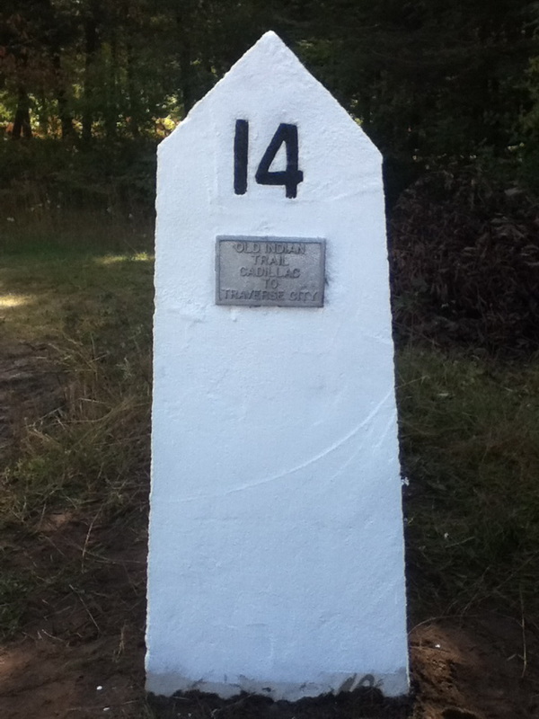
Marker 14 is located at the Pony Jam Crossing. This is one of the brand new stones
|
For thousands of years, the Native Americans of Michigan used both its waterways and traversed the land on well worn trails. The landmarks along these trails included burial mounds and villages. Sometime in the 1200s, the Anishnaabe people starting using this trail. The Anishnaabe formed the three fires, which included tribes of Ojibwe, Odawa, and Potawatomi Natives. Just like the mound builders before them, they used the same trails that were established. One of these "highways" was the Cadillac to Traverse City trail. This trail started on the shores of Lake Mitchell where modern day Cadillac is and finally ended on the shores of Grand Traverse Bay in what is now Traverse City. Most widely used by the Odawa and Ojibwe tribes, it was a way for them to go from the fertile farmland near Cadillac to the waterways of the Great Lakes.
The mapping out of this ancient route started with Milo Petoskey Crosby. Crosby was born in 1875. Crosby was born in the Harbor Springs area, and he was one of the first white children born in that area. The midwife at Crosby's birth was Chief Petoskey's wife. Due to this connection, it was requested that Crosby's middle name should be Petoskey. After moving out of the Harbor Springs area, he moved down to Wexford County, where he was a farmer. Later in his life, he retired from farming and decided to map out the trail to honor his feelings for the Native heritage. To mark the trail, Crosby spent years walking the woods and fields and looked for remnants of the old trail. During the 1940s, he finally placed 14 markers, which started on Lake Mitchell and ended at the Manistee River near Sherman. Later on, James Comp and Ed Babcock, who was a historian and retired Cadillac High School teacher, continued marking out the trail. Picking up where Crosby left off, they placed markers 15-19. 15 was placed on the other side of the Manistee right where 14 is. This site marks the "pony jam" crossing. This is a shallow spot in the river that used to have logs on it, creating a natural bridge. These logs were removed during the lumber era of Wexford County in an effort to clear the river. The trail then continues up towards Buckley and James and Ed concluded with marker 19, just northeast of Buckley. The trail finally got completed in 1987 by former Little Traverse Bay Bands of Odawa Indians chairman Frank Ettawagheshik. Ettawagheshik along with the Grand Traverse Sesquicentennial group placed the final 14 markers that go from Anderson Creek near Hannah up to West End Beach on Grand Traverse Bay. The entire trail is composed of 33 markers total and 32 of them are placed alongside roads so that the entire trail can be driven. Hiking the trail is not advised as most of the trail crosses private property. For more information on the trail, please contact the Wexford County Historical Society. |
